![]()
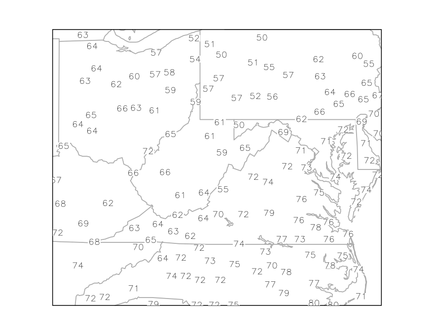
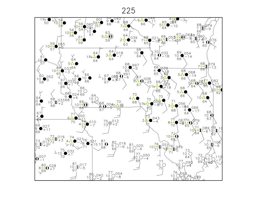
2) Draw the 70 degree isotherm on the map below. Use the technique from Vasquez shown in Appendix 4. Indicate interpolation points along the isotherm, as shown in the graphic at the top of page 216 in Vasquez.
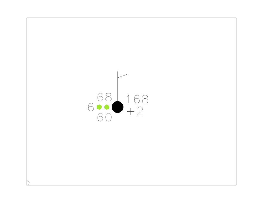
3) Provide the following information from the station model shown below:
Temperature:
Dew Point:
Pressure (mb):
3 Hour Pressure Change (mb):
Wind Speed:
Wind Direction:
Amount of cloud cover:
Current weather:
Visibility:
4) (Vasquez, Problem #1, Page 100) What might be a situation where an isodrosotherm analysis would prove to be useful?
![]()
5) (Vasquez, Problem #5, Page 101) Where is the front located relative to a thermal gradient? Parallel to or perpendicular to it, and on which side?
![]()
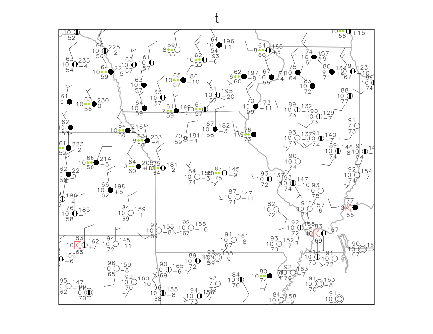
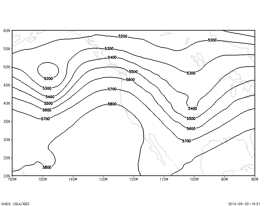
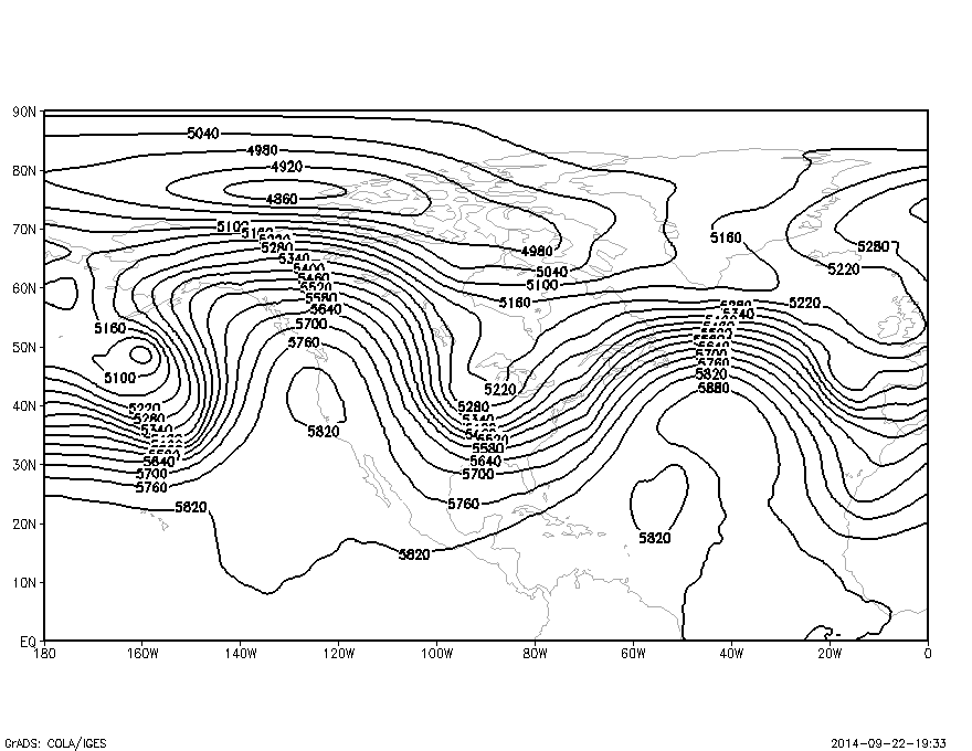
6) Locate and draw the front and/or fronts on the following two maps.
Label the fronts.
See the information provided for Lab#3:
http://wx.gmu.edu/dev/clim301/lab3/lab3.html
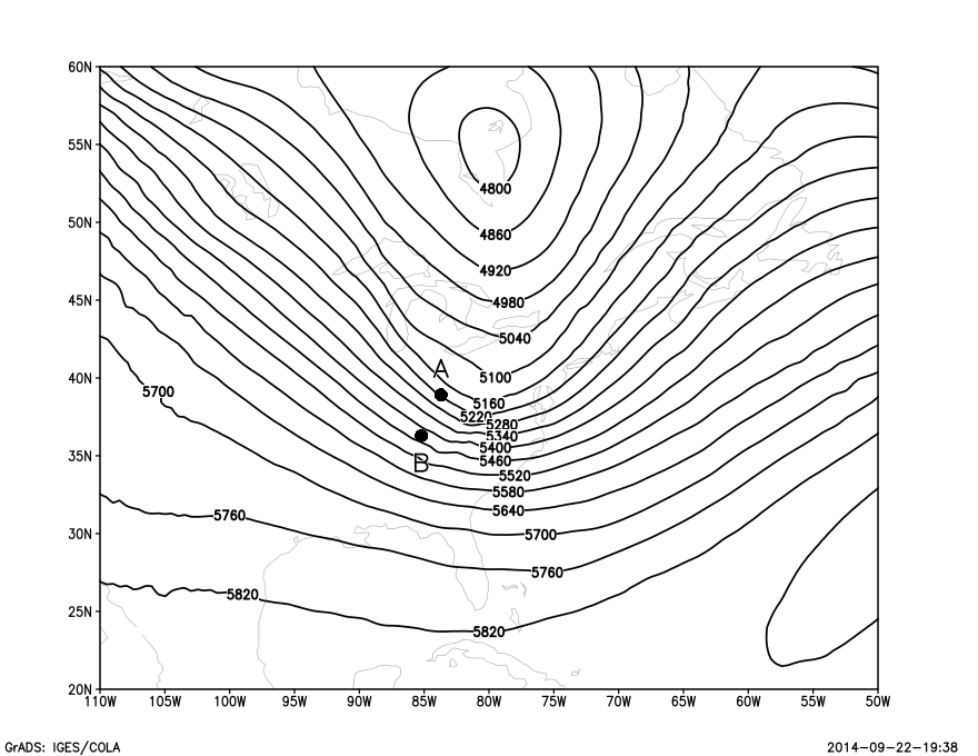
7) Locate and draw troughs and ridges on the following two 500mb charts. (the height contours are labeled in meters, not decameters):
8) On the 500mb chart below are marked points labeled A and B. The actual points are indicated by the small round filled-in circle. At each point, draw an arrow showing the direction of the geostrophic wind. At which point is the geostrophic wind speed higher? Why?
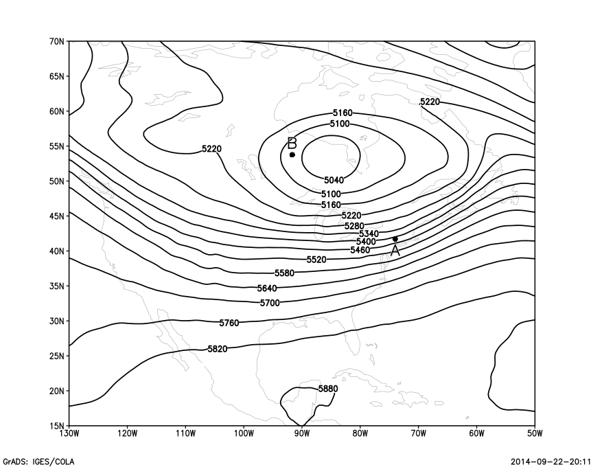
9) On the 500mb chart below are marked points labeled A and B.
Assume the line connecting the two points (line not shown) is perpendicular
to the contour lines. Estimate the height values at point A and B.
Assume that the distance between the two points is 100km. Also assume
the geopotential height changes linearly between points A and B.
Calculate the geostrophic wind speed at the midpoint between points A and B.
Use a latitude of 38 degrees north for this calculation.
Estimate the geostrophic wind direction in degrees.
(note: the lat-lon lines on this map are straight lines and north is up)