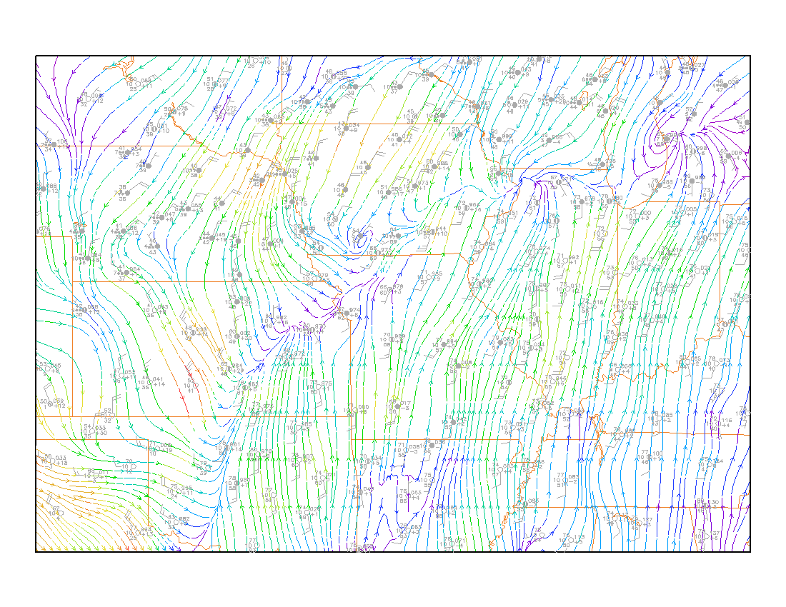
This lab is an introduction to locating fronts on the surface chart.
The assignment is to locate and draw the major fronts on the provided map of surface observations.
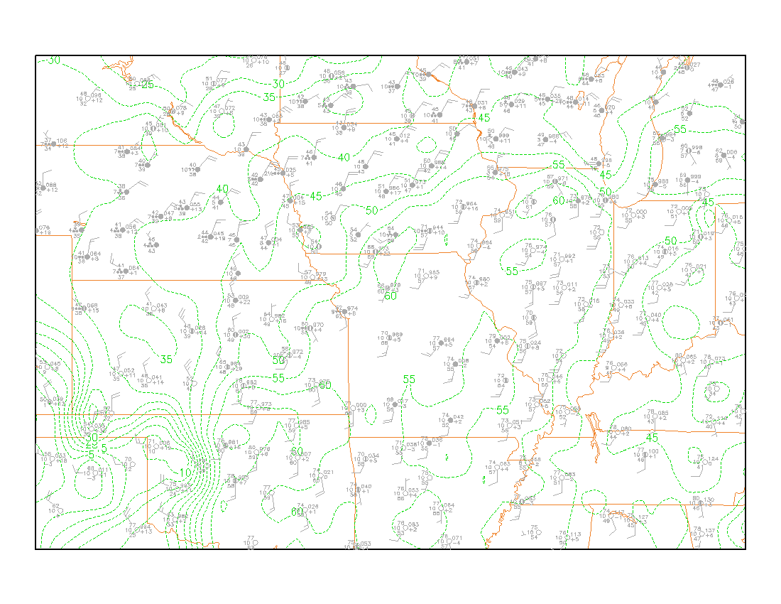
The map is linked HERE.
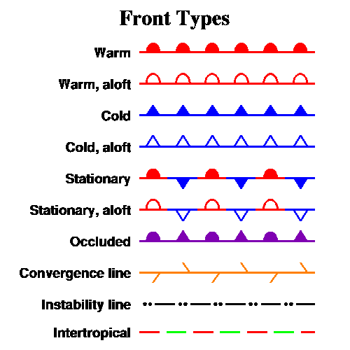
Draw the fronts using the standard notation and color, as discussed in the lab, and as shown below:
Note that the "bumps" on the front are supposed to point in the direction the front is moving. The wind field is used to determine the type of front and the direction it is moving. If this rule is followed, the bumps on a warm front (half circles) will point towards the colder air. The bumps on a cold front (triangles) will point towards the warmer air.
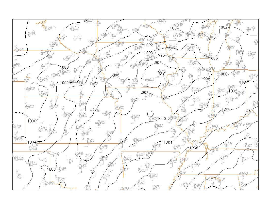
After drawing the fronts, draw isobars at 2mb intervals (the same interval as the computer analysis below). When drawing the isobars, keep in mind that the front usually is a location of low pressure -- a pressure trough.
It is a good idea to draw the fronts lightly in pencil at first, before finalizing their location.
Analyzing fronts requires looking at every meteorological variable.
Pressure: Pressure usually drops ahead of fronts and rises after the front passes. With a strong cold front, this can be dramatic. In some cases, the pressure will rise slowly ahead of a front, but more rapidly after the front passes. If the isobars are drawn on the map, the front will usually be found in a "trough" of lower pressure. It may be appropriate to show the isobar contour lines "kinked" at the front.
Temperature: Fronts usually seperate air masses of different temperature. Within an air mass, the isotherms will be widely spaced, indicating gradual changes in temperature over distance. Near a front, the isotherms will be closely spaced, indicating a rapid change in temperature. The front is usually located on the warm edge of the closely spaced (also referred to as packed) isotherms.
Moisture: Fronts usually seperate air masses having different amounts of moisture. When the moisture is the only significant change across a front, it is sometimes called a "dryline".
Winds: The winds typically shift speed and/or direction when a front passes. On the surface map, winds will usually be different in direction on one side of a front compared to the other.
To summarize: fronts are usually in or near a pressure trough. Fronts are usually along a wind shift line. Fronts are usually located along the warm side of Isotherm packing. If there is packing in the Isodrosotherms (lines of equal dewpoint), the front will usually be located on the moist side of the packing.
Often, when fine-tuning the locatin of a front, the wind shift line is the most important feature. For a stronger front, the winds will shift on the order of 90 degrees or more.
The most useful aids for fine tuning the location of a front is the trough of low pressure and the wind shift line. So look especially closely at the Isobars and the Streamlines.
To aid in locating the fronts on this map, the following computer analyses are provided, including the isobars. Take the time to appreciate the difference between the computer analysis of the data and your own analysis. With practice and experience, "by hand" analysis of the surface chart will be more informative that what the computer can provide.
Temperature
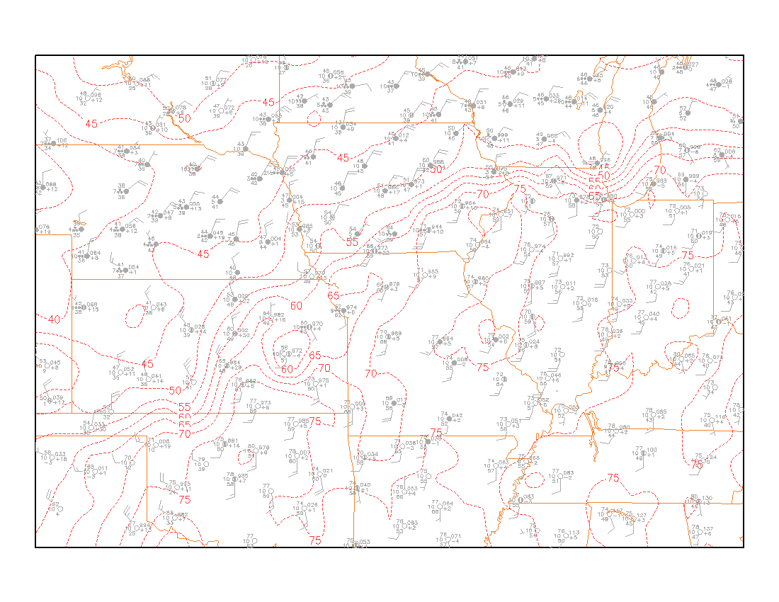
Dewpoint
Winds