The current surface temperature analysis shows moderate temperatures over our area, with the strong high over New England keeping the eastern seaboard cool. There is warmer air to the west of the mountains. Looking further west, the front that was discussed yesterday has moved a bit to the east, and now stretches from Michigan towards the southwest to northern TX. We will focus our discussion on this front and the expected cyclogenesis along it.
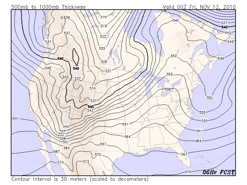
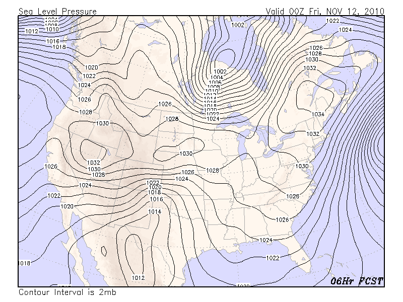
The current 1000-500mb thickness shows the strong baroclinic zone over the great plains. Looking at the surface pressure field, the flow along the northern portion of the front is weak, and the flow along the southern portion of the front suggest warm air advection. (Note that we are using six hour forecasts from the 18Z GFS model run, valid at appx. the current time). Although the front has moved to the east over the last day, it would appear the front has now stalled and may even be moving northwestward as a warm front, particularly along the southern portion.
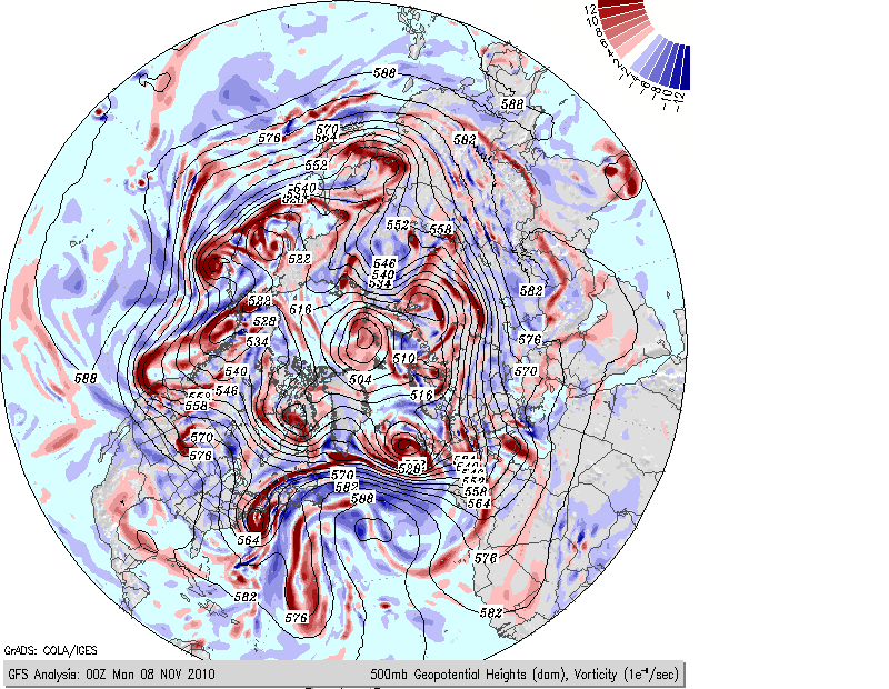
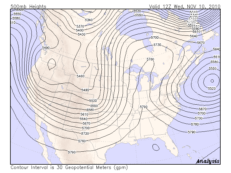
Turning to the 500mb chart, we see the closed upper low to our east hanging tough, and the broad longwave trough still over the western US. We also can see a sharp well-defined short wave trough over southern AZ extending into Mexico. Yesterday morning, this shortwave trough was on the west side of the long wave trough, near the US west coast (see the discussion from yesterday).
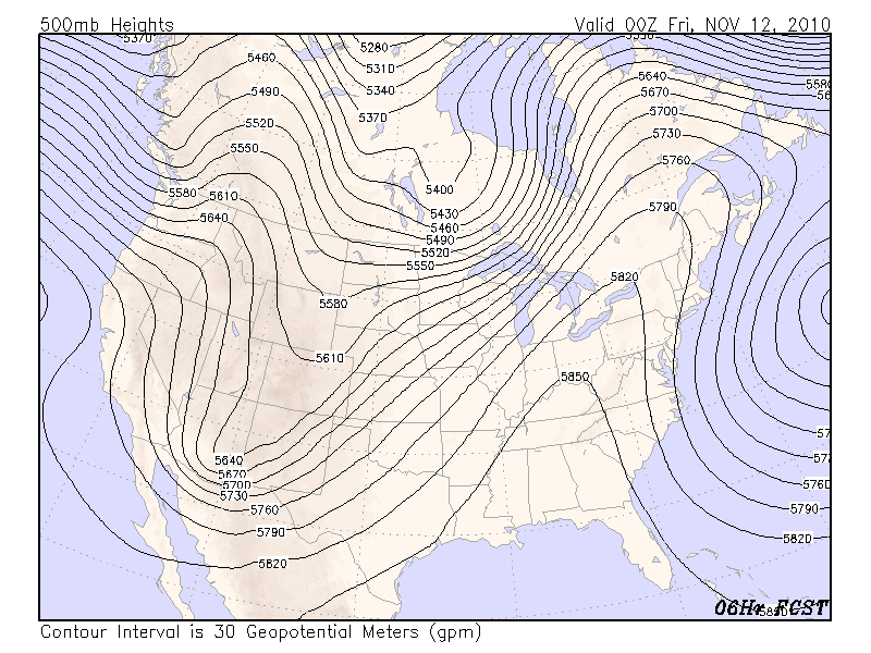
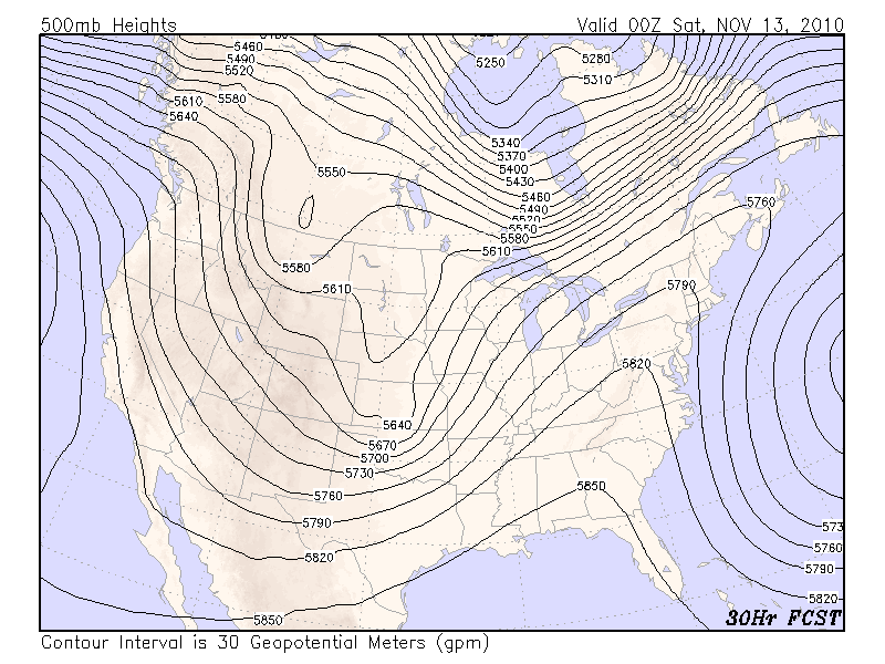
Looking at the forecast 500mb field for this time tomorrow, it can be seen that the longwave trough has not moved much. However, the shortwave trough has moved from southern AZ towards the northeast to KS and OK. It is typical for shortwave troughs that are moving through a longwave trough to travel around the periphery of the longwave trough.
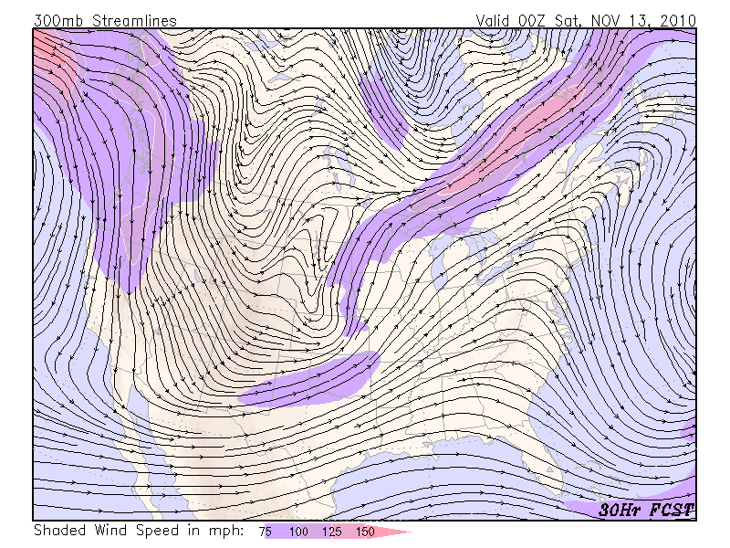
The 300mb jet analysis valid at the same time (tomorrow evening) are not particularly impressive over the great plains, although there is suggestion for an exit region over southeast MO with the LFQ over eastern KS. And, the 500mb vorticity field shows strong PVA over eastern KS.
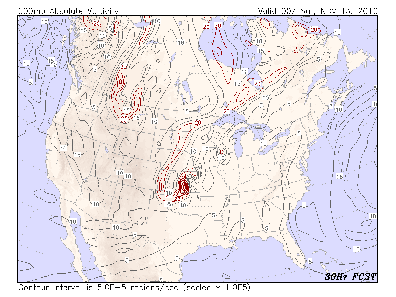
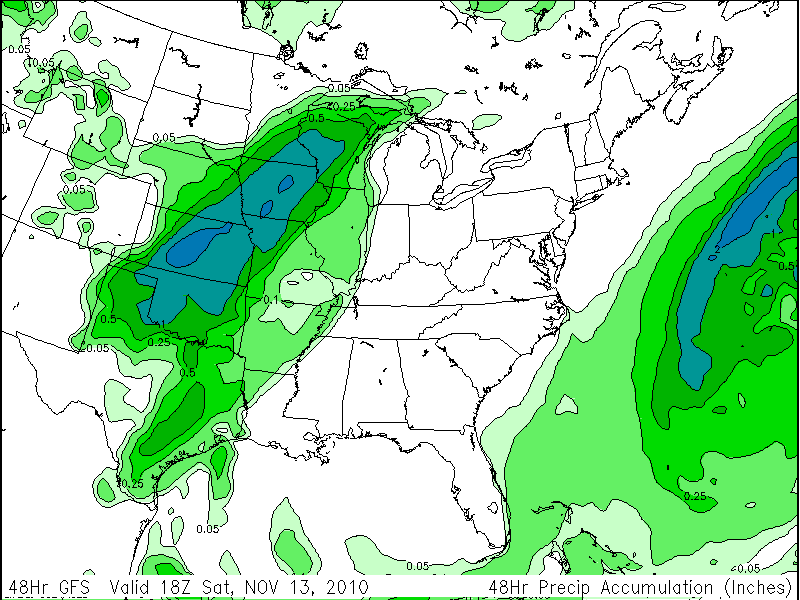
A weak jet exit region, strong 500mb PVA, warm air advection -- all interacting with a strong baroclinic zone -- should generate falling surface pressures, cyclonesis, and large scale ascent ahead of the trough. The precipitable water analysis (not shown) shows values over 1 inch extending along and to the east of the front. Large scale ascending motion and warm air advection ahead of the surface low will result in strong overrunning along the front and precipitation to the west of the front. The model forecast preciptation for the next two days reinforces this thinking, with a large swath of greater than 1 inch rainfall to the west of the front.
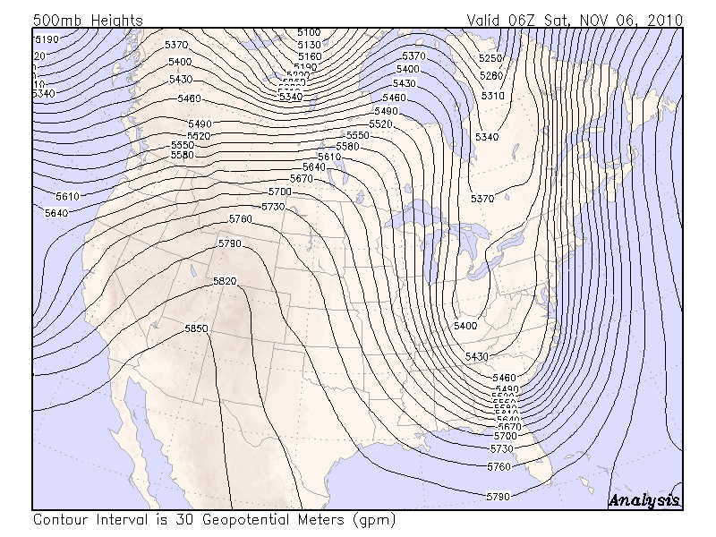
The upper ridging overhead and the surface ridge of high pressure over our area are brining us some very nice weather for November. The blocking ridge over the central Atlantic Ocean has weakened a bit but still does not seem inclined to move. The upper low just to our east continues to spin pretty much in place, with nothing to push it westward. This morning's 500mb height analysis, below, shows the upper low to our east, ridging just to the west of our area, and a large longwave trough over the western US. Within that longwave trough are some shortwaves, such as the one over the west coast and another extending from eastern WY toward the southeast into eastern TX.
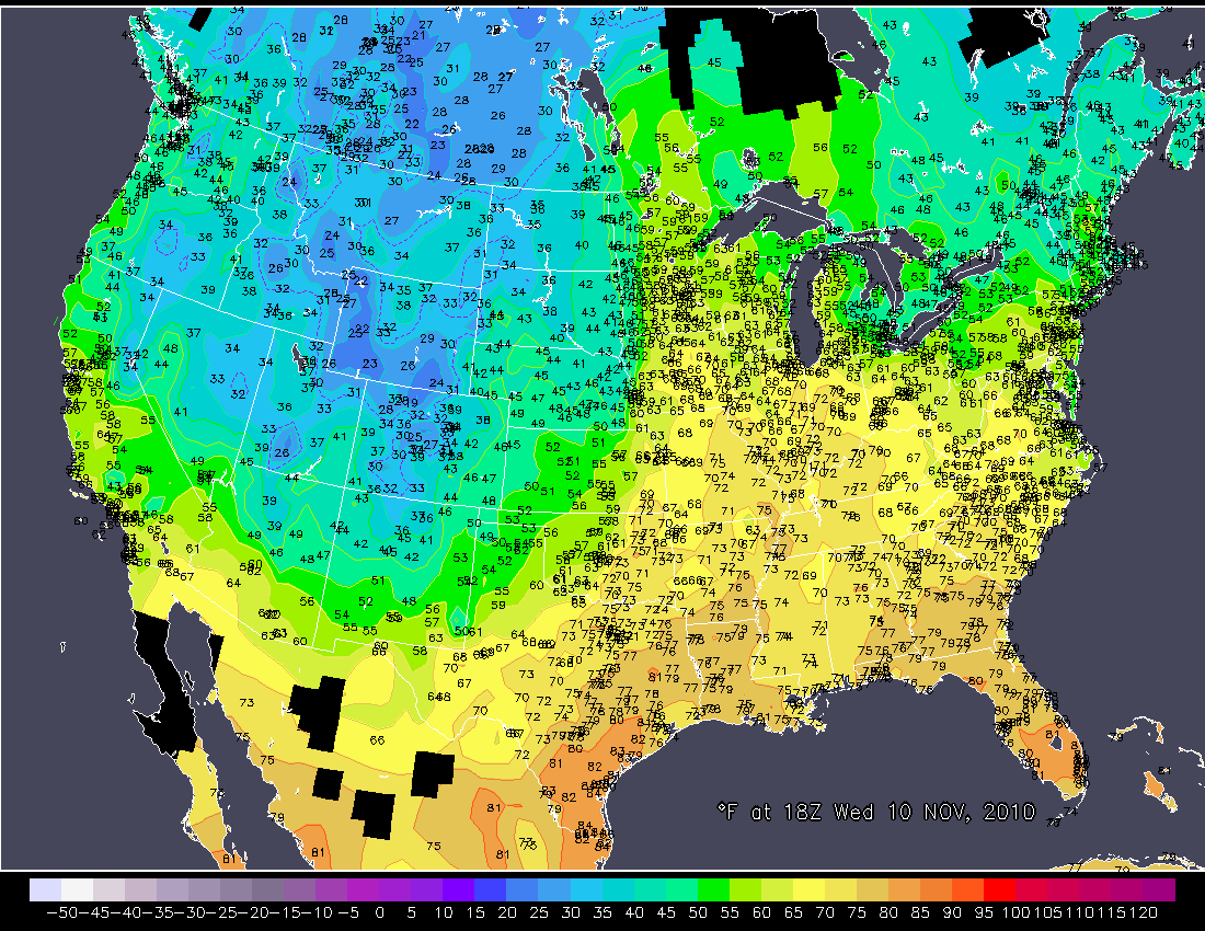
The current surface temperature analysis over the US shows cold conditions over the west, under the large upper trough, and warm conditions from the midwest towards the southeast, under the upper ridge. Note the fairly sharp baroclinic zone extending from western MN southward to eastern TX, suggesting the possiblity of a front.
The current SLP analysis shows a trough in the same area, and the wind analysis, below, shows a wind shift line, confirming that a front lies along the temperature boundary. The models are showing a series of upper shortwaves interacting with this front, producing episodes of showers and rain over the great plains in the next few days. However, the front is not forecast to move very much during this time, due to the overall blocked upper pattern.
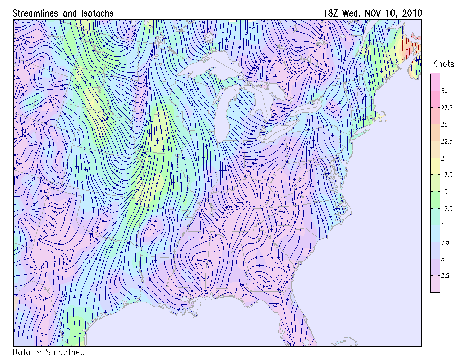
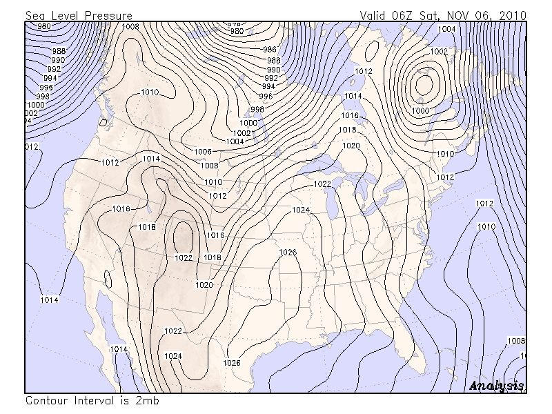
The surface wind analysis also shows our area still under the influence of the low pressure to our east, with a general northerly flow.
Finally, looking at the current satellite picture, the clouds along the front in the midwest can easily be seen, along with the general cloudiness to our east from the vertically-stacked low over the western Atlantic Ocean. The clouds from that low have thankfully stayed to our east. Yesterday the low wrapped a fair amount of moisture over our area, but the general downsloping pattern provided sufficient subsidence to keep our skies mainly clear.
Given the blocked upper pattern, we can expect continued clear skies and moderate temperatures for at least a few more days.
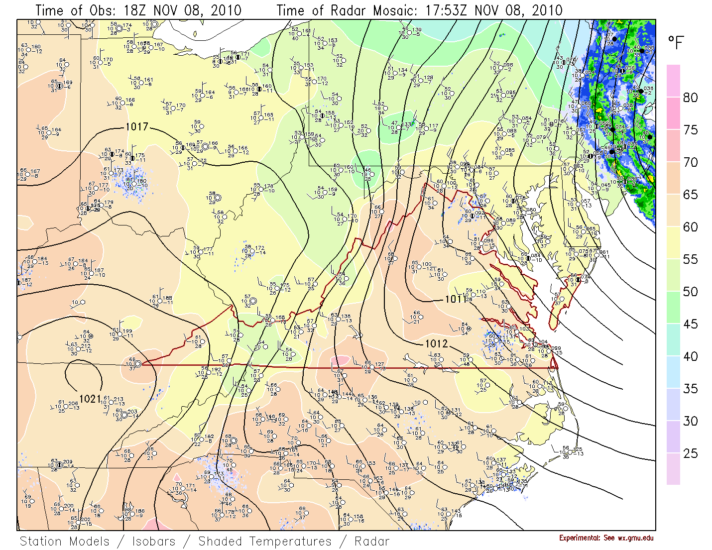
Looking at the current surface analysis, which shows the radar, the isobars, and the isotherms all on the same plot, we can see that the intensifying low pressure over New England has resulted in increased pressure gradients over our area giving us breezy conditions. Also of note is the band of rain on the upper left edge of the analysis, over New York and far eastern PA, indicating how much the low has wrapped clouds and rain back to the west. It is also interesting to note the relatively warmer conditions in our immediate area, as compared to surrounding areas to the east, north, and west. This is indicative of downsloping that is warming the air, as is typical for our area when the winds are from the northwest and the air is relatively dry. So far the downsloping is also giving us clear skies, but as the low continues to spin moisture westward, some clouds are still expected sometime over the next day or two.
For the prior week, click on the link at the top of this page.
Now that we are on EST, note the difference between Universal time
and local time is 5 hours.
So 00Z is 7pm the previous day; 12Z is 7am, etc.
The very deep and elongated trough over the eastern US has been moving very slowly to the east, first sharpening then closing off as it moves. Note its evolution over the last two days. Early Saturday morning it extended into the deep south, with fast upper air flow extending from Canada all the way to the gulf coast. It should come as no surprise that overnight freezing temperatures extended all the way to northern Florida.
As the upper trough has moved east and interacted with the front to the east, it has formed a strong low that has wrapped back into New England, bringing wind and heavy rain onshore. The intensification of the surface low has increased pressure gradients over our area, and will bring us increased breezy conditions for today. It is also maintaining a continued northerly wind flow, which will keep us cooler than normal.
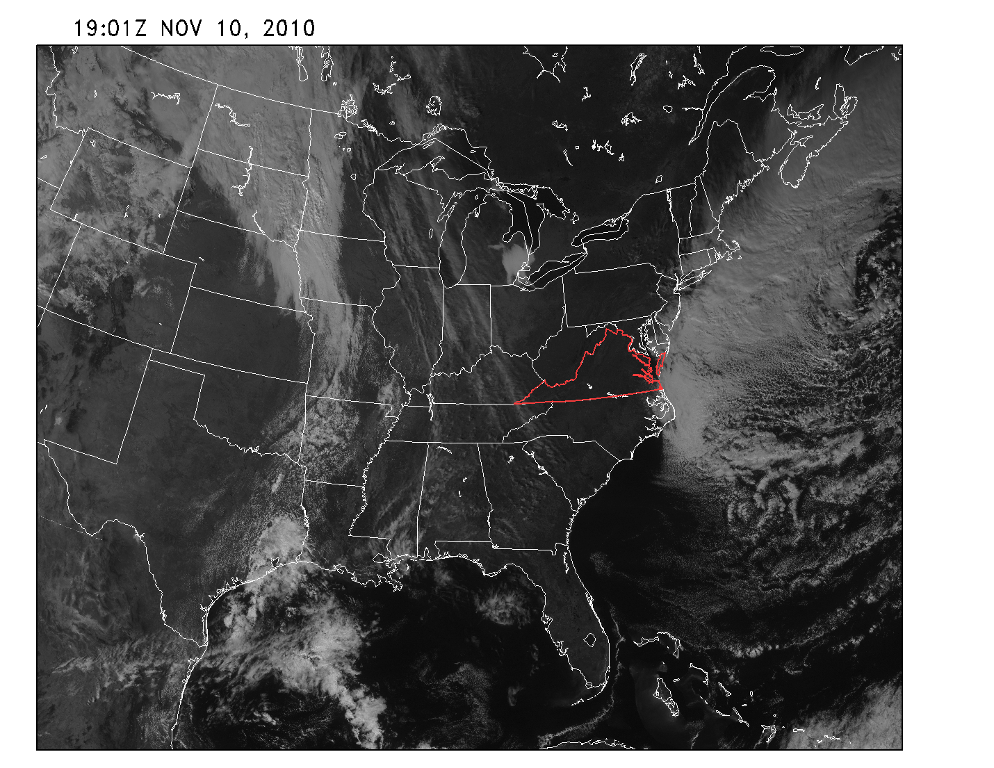
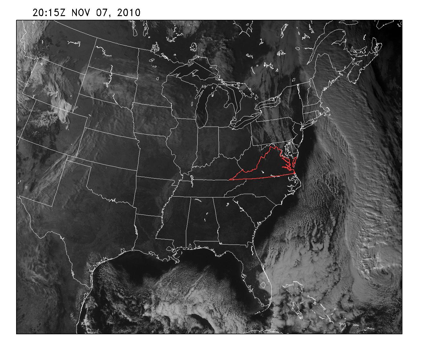
Looking at the satellite photo from yesterday, the strong baroclinic zone to the east is plainly visible. Note the remnants of Thomas in the lower right corner of the image. Also note the band of clouds over the eastern US just to our north. These are clouds that have wrapped around the closing low. As lows wrap up and close off and become nearly stationary, they can wrap moisture around themselves, back to the west. We may get more of this today, as the low continues to wrap up to our east out over the ocean. It may bring us quite a bit of clouds for a time later today, and perhaps even some sprinkles, and rain near the coast.
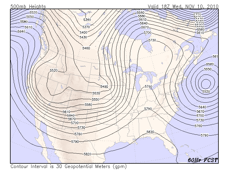
It appears that as the remnants of Thomas get absorbed into the large low system to our east, it will strengthen that system, and the models are showing that system slow to move further east. While the low remains close to the coast, we have the risk that the low will wrap bands of moisture over us, possibly bringing us periods of clouds. We will also stay under northerly flow, produced by the pressure gradient between the low to the east and the high to the west. The model indicate the pattern very slow to change, with a very strong ridge slowly building over us. See the model forecast at 500m for the middle of this week, showing the ridge extending from the gulf coast to Hudson Bay. Assuming the low to our east does move a bit further east, allowing the ridge to build as forecast, much of the week will be clear and dry with moderating temperatures.
The large trough in the western US will eventually work its way east, but the models are showing the overall pattern is moving very slowly. It is likely there is blocking somewhere in the northern hemisphere. A quick look at the hemispheric analysis at the 500mb level shows a blocking ridge over the central Atlantic Ocean. This is the probable explanation for the slow movement of the weather systems forecast for this week. This block may bring us a long period of tranquil weather, while it may also bring a prolonged period of stormy weather to the US central plains and west.