Go Back to the Week of Nov 7, 2010
A well defined short wave over OK and TX has an associated surface low, and some precipitation can be seen on radar over KS and MO.
A typical comma-shaped cloud pattern can also be seen on the satellite photo over the same area, assocated with the upper trough. Also seen on the satellite image is the front which passed through our area last night, now moved offshore to the east and extending over FL into the gulf.
As the upper level trough and energy over TX moves to the east, it will not find significant energy for development. Lower level moisture has been swept offshore due to the frontal passage overnight, and there is no substantial baroclinicity, also due to the recent frontal passage. Thus this trough will not strenghen, and the models forecast a weakening trend. Nevertheless, as the trough passes over our area tomorrow, we will see increased levels of cloudiness, and behind the system a reinforcement of colder air, giving us cool temperatures following the passage of the system.
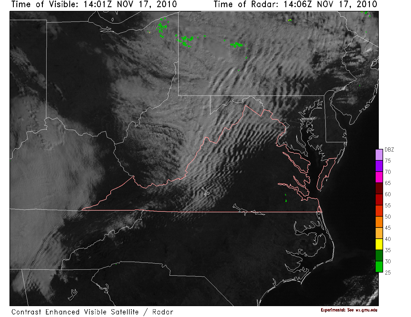
The strong wind flow over the mountains is producing some interesting waves in the atmosphere. The clouds are even reaching our area, which may keep the winds down a bit if it lasts.
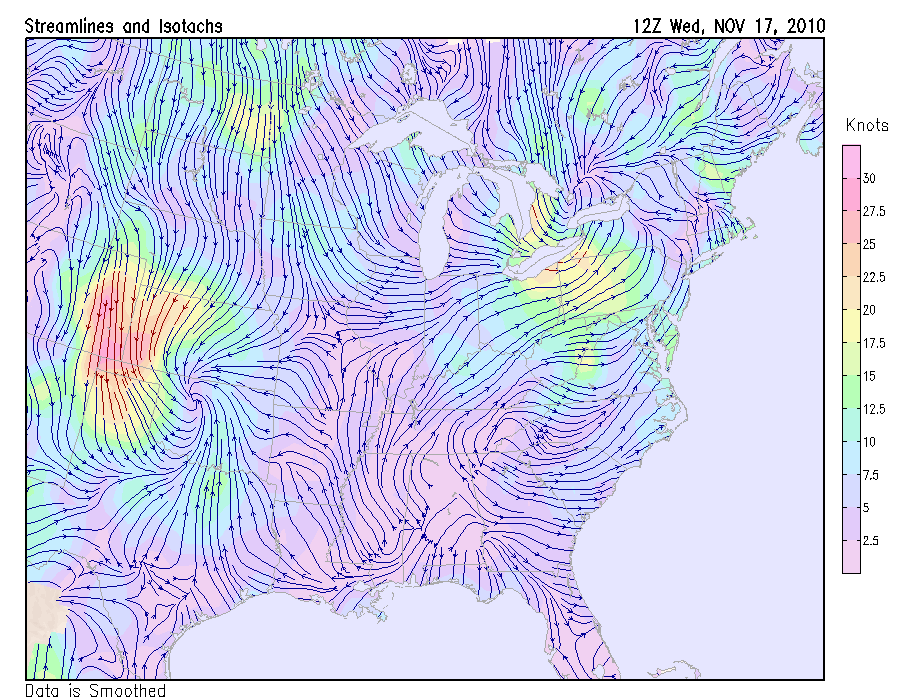
A strong pressure gradient behind the departing low is producing strong winds. especially to the northwest of our area. With full sun today and downsloping from westerly flow keeping it clear and warm, the expansion of the PBL will bring momentum from aloft down to the surface, possibly producing wind gusts in excess of 40mph in our area. For this reason the NWS has issued a wind advisory for today.
As the front approaches, a nearly solid line of heavy showers and thunderstorms have persisted, and strengthened east of the blue ridge in the warm moist air pulled northward over the coastal plain by the strong southerly flow east of the low. SPC has just issued a severe thunderstorm watch for our area, valid until 4am, with the primary threat being high winds.
It is unusual to have severe thunderstorms in the middle of the night in mid-November.
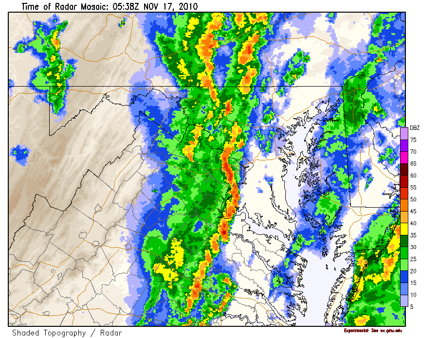
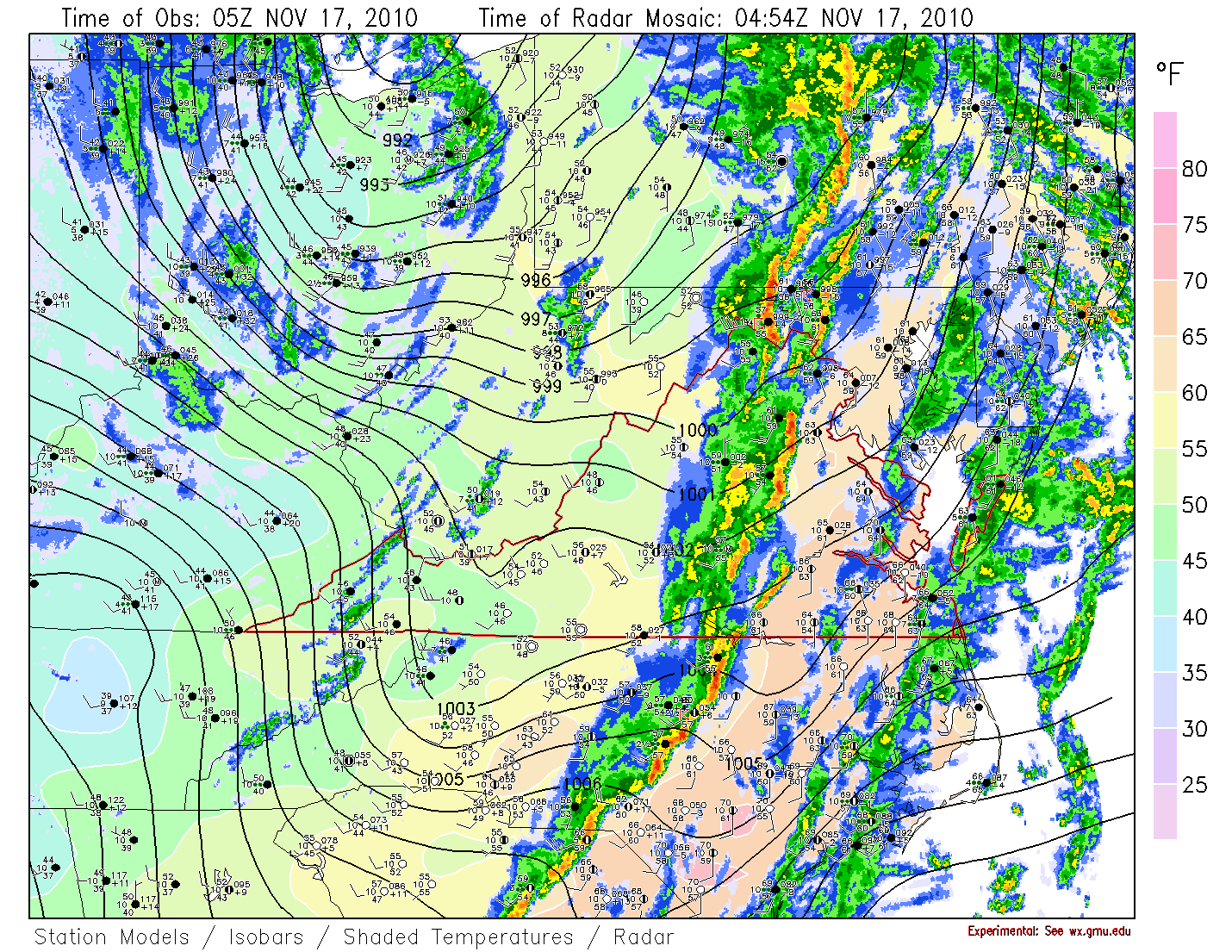
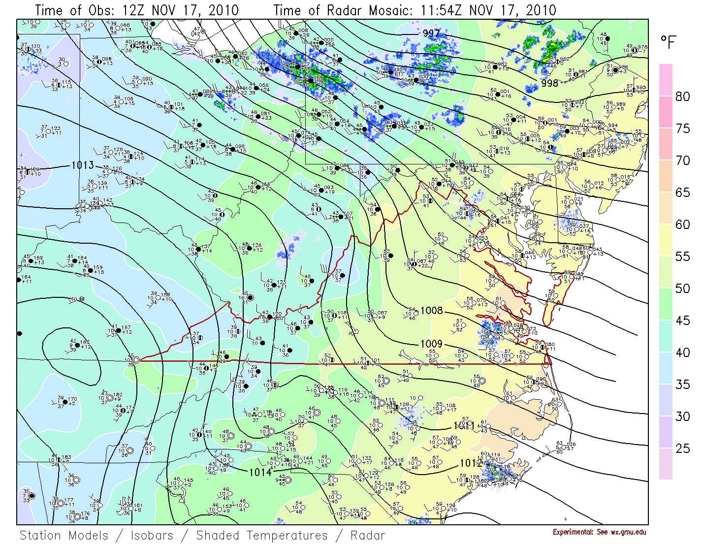
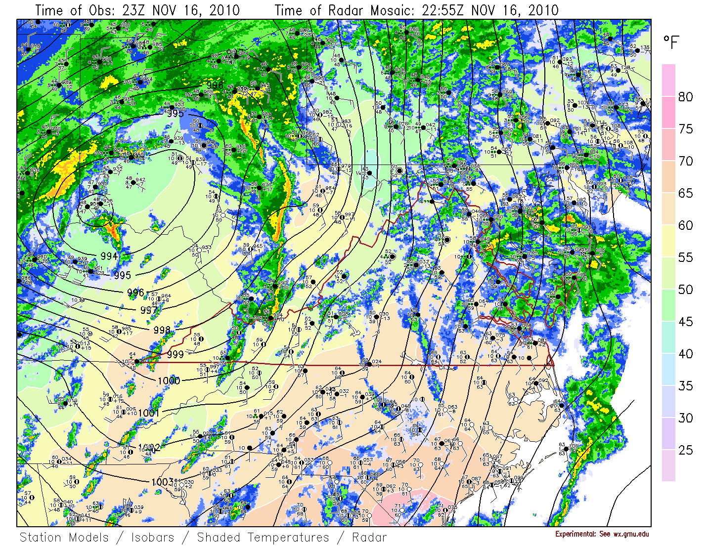
The current surface map shows the 993mb low over extreme SE Ohio, with scattered showers over our area. There is an interesting band of heavy showers (with thunder?) extending north/south over WV. This may be on the leading edge of the main vorticity lobe, and also along a cold/occluded front. This line may continue eastward and pass through our area overnight with the frontal passage, giving us brief heavy rain and possibly thunder with gusty winds.
Overall, the current weather pattern demonstrates a very typical process of an upper shortwave interacting with a pre-existing baroclinic zone and developing a low, which reinforces and strenthens the upper short wave which strengthens a surface low which moves to the northeast along the front. Of course there are always particulars which are different for every system.
Not all of the maps being discussed will be presented here.
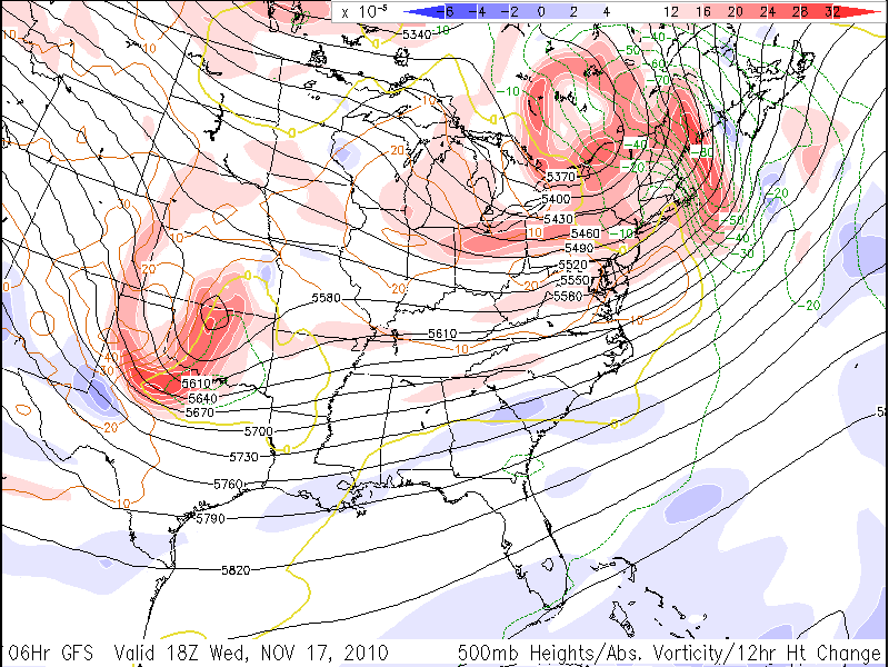
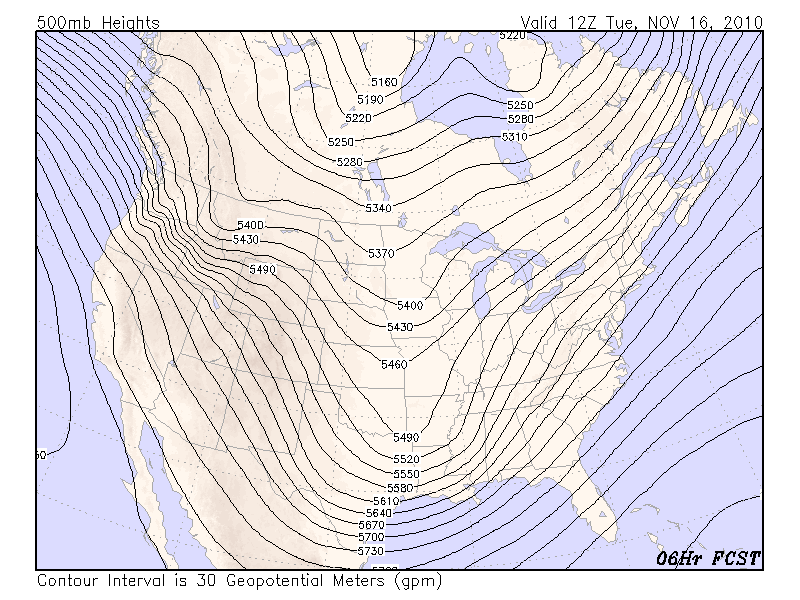
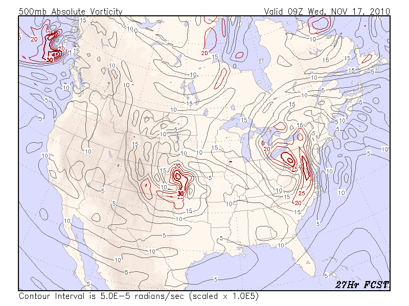
Looking at the upper air pattern, at 500mb we see a well defined short wave stretching from MN directly south to southern TX. There is another short wave near Idaho. These shortwaves are imbedded in an overall long wave pattern with the long wave trough over North America. The forecast maps for this trough indicate it will move to the northeast and strengthen. Looking at the 500mb vorticity, there is currently only a weak vorticity maximum at the base of the trough over eastern TX. The forecast maps show the vorticity maximum strengthening rapidly as the trough intensifies, with a vorticity maximum over 30x10^-5 passing overhead around 09Z tomorrow (4am EST). The passage of this vorticity maximum would define the end of any precipitation (not considering other processes yet).
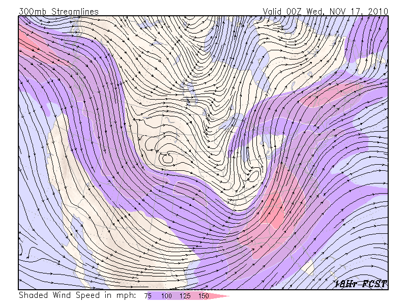
Looking at the 300mb jet, we see a jet maximum running around the long wave trough from New England southweastward to the gulf then west accross Texas then northwest to the northwest states to the Pacific Ocean. Embedded in this large scale longwave jet are some features associated with the shortwaves. A jet maximum currently runs from overhead southwest to TX. The forecast maps show, as the trough strengthens, a well defined jet exit regiong forming, with the LFQ at 00Z Wed over OH.
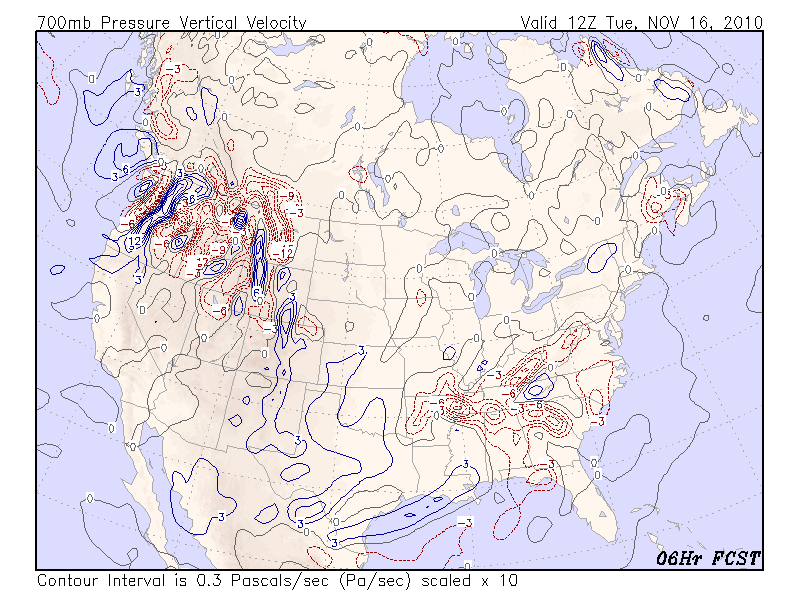
Looking at the current 700mb height pattern, the shortwave trough over the south is clearly seen, along with some additional structure, with the suggestion of two shortwaves, one over AR, and one over the TX and LA border. The 700mb forecast maps show the trough deepening and forming a closed low at 700mb in 12 hours, with the closed low moving up the Ohio valley. The 700mb vertical velocity (vv) map shows a broad area of ascending motion (negative values) from overhead through much of the southeast US. The forecast maps of vv indicate this broad area of ascending motion will slowly translate to the northeast ahead of the trough. It appears most of the ascending motion at this level will be beyond our area by early Wed (coinciding with the passage of the 500mb vort max).
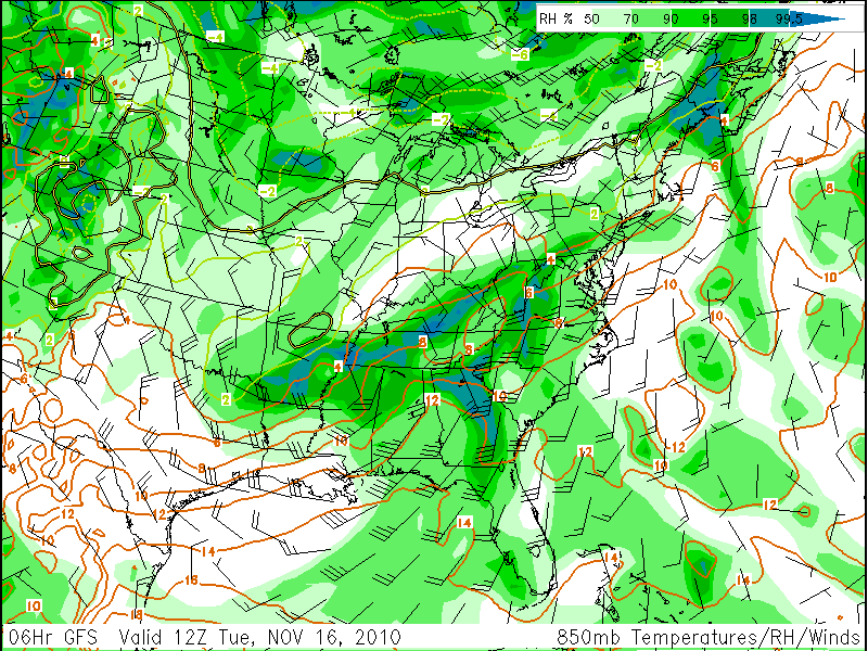
Looking at the 850mb chart, we see high relative humidities over the entire southeast US. The temperature analysis shows a baroclinic zone stretching from just south of New England, over our area, then to the southwest. The wind field shows strong southerly flow over the entire southeast US, and a closed circulation over AR. This pattern clearly suggests a low over AR with a warm or stationary front extending from the low to the northeast, and a trailing cold front streatching from the low to the southwest.
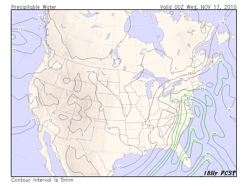
Looking further at the moisture fields, we turn to precipitable water. Almost the entire southeast US is covered by precipitable water values in excess of 25mm (over an inch) with maximum values near the southern coast over 40mm. The forecast maps show this moisture streaming nothward ahead of the trough with values over our area reaching 35mm at 00Z Wed.
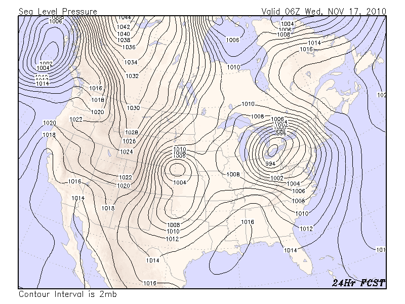
Now turning to the surface pattern, we see a surface low over northern MS and broad high pressure over New England. The thickness pattern shows an extensive baroclinic zone streatching from northeast to southwest over the eastern US. It is also noteworthy to observe the thickness plotted with the SLP field, and seeing the large area of strong warm air advection over the our area and over the entire southeast quadrant of the US (the slp lines cross the thickness lines at nearly 90 degree angles). Also noted at the surface are the relatively warm temperatures over the southeast, with cooler temperatures to the north over our area. It seems the front that passed slowly from west to east over us yesterday is now located over southern VA, based on the current surface temperature analysis (not shown).
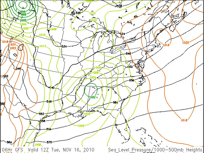
Looking at the surface map forecasts, the low will deepen and move to the northeast and pass well to our west over OH. and brining a cold front through our area in the early morning hours on Wed.
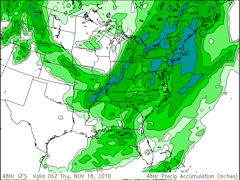
Putting all these pieces together, the broad scale advection of warm moist air over the southeast is causing that warm air to overrun the cold air near the surface resulting in broad scale lift and stratiform precipitation over our area and elsewhere north of the warm front. As the trough deepens and moves toward us, dynamic lift will strengthen and the precipitation will take on a more convective nature and intensify. The most intense preciptiation for this system will be to our west, under the LFQ of the upper jet and just to the north and west of the surface low. As the cold front passes, along with the passage of the 500mb vorticity maximum on early Wed, the precipitation will end. As the surface pressure gradients strengthen as the low deepens, winds in our area should pick up, with Wed. being breezy and cooler. In spite of cold 850mb temps on Wed, downsloping will likely keep the temperatures here from being too chilly, with sun and highs near 60.
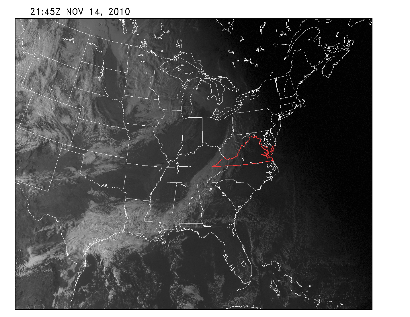
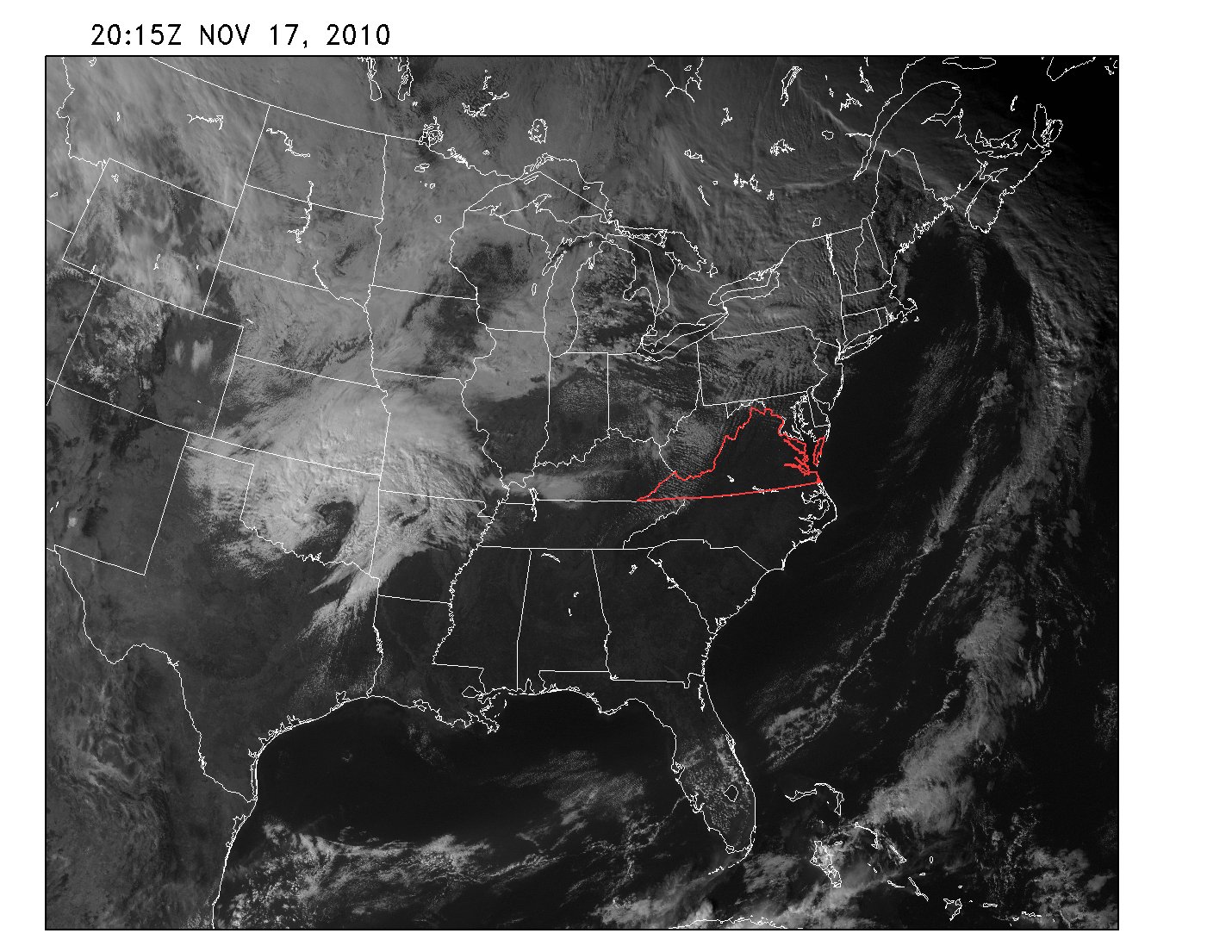
On Friday we discussed the developing low over OK and KS and how it would move to the north and sweep a trailing cold front behind it, pushing the front to the east. The low developed as predicted and dropped the first major snowfall over northern MN and WI. As can be seen on the current satellite picture, a band of clouds stretches from western PA towards the southwest to the gulf states. The movement of the front has slowed and the front has weakened somewhat, and fortunately the clouds and light showers associated with the front have stayed west of the mountains, giving us a very nice day today.
Looking at the 500mb pattern over the next few days, the next short wave to move around the long wave trough is expected to drop to the Gulf of Mexico and then strengthen as it encounters the baroclinic zone (ie, the front). Extenseve cloudiness over eastern TX, as shown on the satellite picture, suggests the beginning of this process is taking place.