Go Back to the Week of Nov 7, 2010
Go Back to the Week of Nov 14, 2010
Looking again at the surface temperatures this morning, the cold air that was over the Canadian great plains has moved to the southwest over the mountains and to the coast. Temperatures have fallen to freezing or below all the way to the coast as far south as California. Very cold temperatures are anticipated in the central valley of CA tonight, possibly having a major impact on agriculture there. For cold air to move this far west and south requires a jet stream pattern that will move lower troposphere air from Canada to the southwest, and the availability of unusually cold air over Canada. This is not very common, but it does seem to happen every few years. I am hopeful that the oranges and strawberries in California will survive this unusual cold snap (since I very much enjoy eating them).
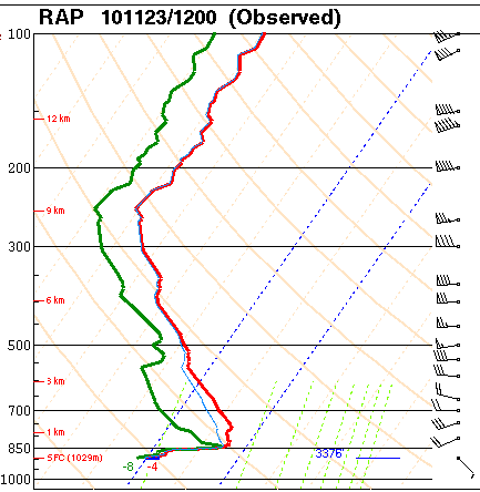
This morning's sounding from Rapid City SD is interesting. The dense cold air from Canada has been moving south, to the east of the mountains. Notice how thin the layer of cold air is, only about 50mb thick. (Also note the tropopause at about 250mb.) The Skew-T plot is from the SPC web site.
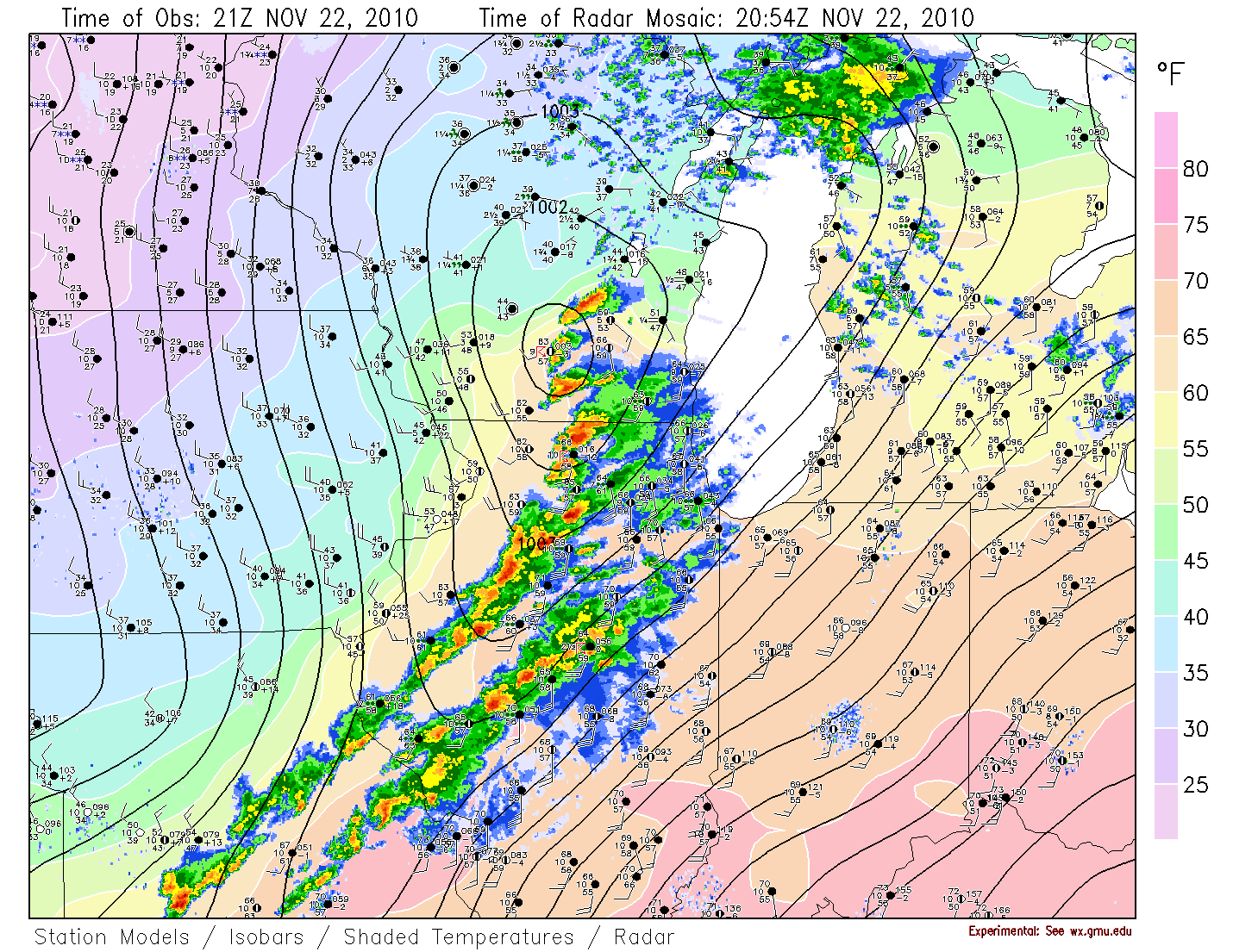
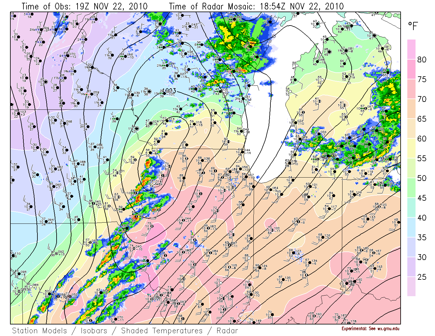
Very cold in the Canadian great plains this morning, with surface temperatures less than -30F. The front to our west is also visible, stretching from near Toronto through OH then southeast to TX. The low that yesterday was over IL has now moved well north into Canada. The associated upper trough is progressive and moving east, and the front will not be parallel to the upper flow, so it will keep moving eastward across the mountains. Dewpoints over our area have risen to about 50F. With moisture available, and with the front moving through, some showers today are likely for our area.
Very strong dynamics and shear along the front in the midwest earlier today, but limited instability. There was just enough energy at the time of maximum heating to produce a supercell generating a few tornadoes. SPC is showing a few tornado reports from far north-central IL into southeast WI. The surface map below, for 3pm CST, is close to the time of the first tornado reports.
Interesting weather in the midwest. Marginal instability (Lifted Index of -3) but strong wind fields at all levels, surface dewpoints over 60F ahead of the front, and good vertical shear. SPC has issued a tornado watch for that area.
The 300mb jet LFQ and 500mb PVA are well to the northwest of the surface low. This is an example where the surface front and low are not well aligned with the upper dynamics, and thus rapid cyclogenesis would not be expected until the low moves further north in better alignment with the jet structure.
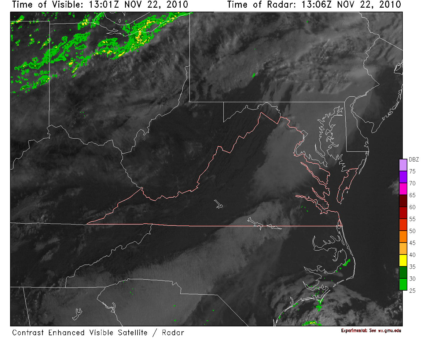
As can be seen on the local surface analysis for this morning, there is a lot of fog being reported. At many stations the visibility is 1/4 mile, which is low enough visibility to affect airport operations.
The visible satellite image from this morning also shows the area of fog that has developed in our region.
Fog can be a particularly difficult forecasting problem. On some clear nights when the radiative cooling drops the temperature to the dewpoint, fog does not form. Other nights, widespread fog will form. There are many factors to consider. Remember that for fog to form, it is necessary to cool a fairly thick layer of air near the surface to an extent sufficient for moisture saturation. Just cooling the air very close to the ground to the saturation point will not be sufficient for fog to develop, as instead the excess moisture will deposit on the surface as dew or frost.
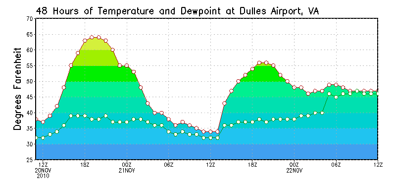
The conditions for fog to form from radiative cooling are the same as those conditions needed for maximum radiative cooling -- clear skies at the beginning of the night and relatively calm winds. In addition, having the night begin with the dew point depression fairly small will increase the odds of fog forming, since the temperature does not need to fall as far. Note from the temperature and dewpoint traces at Dulles that the dewpoint has been rising over the last day.
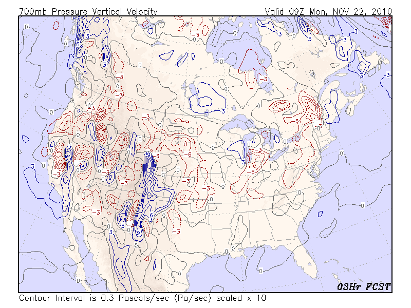
Another factor is the large scale vertical motion. If the large scale vertical motion is subsidence, it will be much harder for fog to form, since the subsidence will result in a process that reduces the relative humidity and keeps any moisture near the surface. You can see from the analysis of the 700mb vertical motion from the early morning hours that there was little large scale vertical motion in our region, and there is the suggestion of weak ascending motion over our area.